A note: As of 2022, I no longer use the writeup format used herein.
I was too lazy to change this one to the new
style. The info is all here, but it just took too much time to do each trail like this, so I
shortened to the new format used in trail descriptions starting in 2022.
June 12, 2019 - A beautiful hike that loops around McKenzie River waterfalls, blue
pools and old growth forests. This hike is easy, with smooth
trails and little elevaton gain. It can be extended to Clear Lake (which we did) for a moderately difficult
(only because of length) 10-miler. Plan to take lots of pictures.
Caution: There are some very sharp and long dropoffs, especially on the west side of the river. Keep
children close and yourself on the trail. With my two-year old
grandson, I would hike the out and back and stay on the east side of the river.
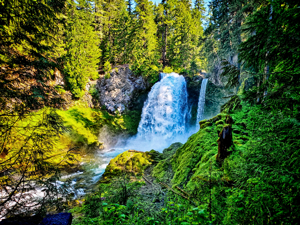
- Main Attraction: Beautiful fast moving river with stunning waterfalls and old growth
forest. .
- Difficulty: Easy to Moderate - Family friendly (some steep drops) - (use
caution).
- Distance & Elevation: 2.4 Miles: Elevation range 2625' to 3001'
+572' -572'
- Type: Loop: Barkdust and well-trod trails
- Usage: Heavy Usage especially in summer.
- Fees: No Fees
- Driving Directions
Amenities & Other Goodies:
- Vault Toilets (Sahalie Falls only)
- Accessibility: The Sahalie Falls viewpoint is fully accessible with easy access along a
paved pathway.
- No Water
- Bend and Sisters Eateries, Pubs and Breweries
Should you hike it?
- 👍 Yes - Hike this trail if: you love fast moving water, waterfalls and old growth
forests and are looking for something that is easy on both the feet
and eyes.
- 👎 No - Do NOT hike this trail if: you are looking for solitude. You will find it
crowded, especially in the summer. Nor is this a true wilderness hike,
what with man-made structures.
Per the USDA Forest Service: "Sahalie Falls and Koosah Falls
are located along the McKenzie Pass-Santiam Pass and West Cascades
National Scenic Byways off Highway 126. The Waterfalls Loop Trail, part of the McKenzie River National
Recreation Trail, connects the two waterfalls and offers up close
views of the wild McKenzie River. These falls mark the terminus of two thick flows of basaltic andesite
lava that dammed Clear Lake and moved into the McKenzie River 3,000
years ago. The results are two breathtaking waterfalls with foaming white water cascades in between.
Sahalie (or "Heaven") and Koosah (or "Sky") are Chinook Jargon words
- part of a rudimentary trade language that allowed people to exchange news and goods in the area. The
Kalapuya, Molalla, Sahaptain and Chinook peoples traveled and traded
here, perhaps on their way to obtain obsidian in the high Cascades or to gather huckleberries.
"Beginning at its northern junction with the McKenzie River National Recreation Trail #3507,
Water Falls Loop Trail travels the east side of the McKenzie
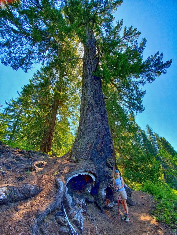
River bearing south. The trail passes through an old growth conifer forest as it reaches the Sahalie
Falls viewpoint, then continues south to the Koosah Falls viewpoint
before reaching its southern end where it rejoins the McKenzie River Trail. You can make a loop by
connecting with the McKenzie River Trail."
We did the hike starting at the Sahalie Falls parking lot and went north towards Clear Lake. You can, as
described above, do it going south. The trails are "easy on the
feet" as they are prmarily bark- and vegetation-covered. The most elevation gain and loss (about 400
feet) is on the southern half of the trail. It is worth it to see the
gorgeous river and forest. Most of the loop hike is forested, helping you to avoid much of the hot
Central Oregon sunshine.
ROD'S RECOMMENDATION: This is a great hike. If you are with small children, stay on the east side
and avoid the west side. Perhaps I am over-cautious, but I can
visualize a very young child getting wrapped up in the excitement and taking a tumble over the
unprotected west side. Older children should be fine, but keep an eye on them.
We combined the 2.5 mile loop hike with the loop around Clear Lake, making it 9.71 miles. If you are in a
time crunch, then save Clear Lake for another day. For the Clear
Lake hike, begin at Clear Lake
Resort if you don't want to do the extra mileage from the Sahalie
parking lot. The Clear Lake circuit hike is a bit more exposed on the east side of the lake, so hiking
that in cooler weather might be a good alternative.
After our hike, we stayed in Bend at the Cascade Lodge. This place, while nothing to write home
about in terms of elegant retreats, was exactly what we wanted: a place to shower and conk out after a
long day. It was quiet, the owners were friendly. We paid about $70.
Optionally, if you want to pack up the camping gear or RV, there are several
places to camp in and around Bend.
After a relaxing shower, we had dinner at the Sunriver
Brewing's Galveston Pub.
A great place for beer and pub food, which is sort of a no-brainer for us after a ten-mile hike. After a
coule beers each and with our bellies full, we slept like babies.